WhatWeather.today
Weather by Country
United States
Afghanistan
Albania
Algeria
American Samoa
Andorra
Angola
Anguilla
Antigua and Barbuda
Argentina
Armenia
Aruba
Ascension Island
Australia
Austria
Azerbaijan
Bahamas
Bahrain
Bangladesh
Barbados
Belarus
Belgium
Belize
Benin
Bermuda
Bhutan
Bolivia
Bonaire, Sint Eustatius
Bosnia and Herzegovina
Botswana
Brazil
Brunei
Bulgaria
Burkina Faso
Burundi
Cambodia
Cameroon
Canada
Cape Verde
Cayman Islands
Central African Republic
Chad
Chile
China
Colombia
Comoros and Mayotte
Congo
Congo Dem Rep
Cook Islands
Costa Rica
Cote d'Ivoire
Croatia
Cuba
Curaçao
Cyprus
Czech Republic
Denmark
Diego Garcia
Djibouti
Dominica
Dominican Republic
Ecuador
Egypt
El Salvador
Equatorial Guinea
Eritrea
Estonia
Ethiopia
Falkland Islands
Faroe Islands
Fiji
Finland
France
French Guiana
French Polynesia
Gabon
Gambia
Georgia
Germany
Ghana
Gibraltar
Greece
Greenland
Grenada
Guadeloupe
Guam
Guatemala
Guinea
Guinea Bissau
Guyana
Haiti
Honduras
Hong Kong
Hungary
Iceland
India
Indonesia
Iran
Iraq
Ireland
Israel
Italy
Jamaica
Japan
Jordan
Kazakhstan
Kenya
Kiribati
Korea, North
Korea, South
Kuwait
Kyrgyzstan
Laos
Latvia
Lebanon
Lesotho
Liberia
Libya
Liechtenstein
Lithuania
Luxembourg
Macao
Macedonia
Madagascar
Malawi
Malaysia
Maldives
Mali
Malta
Marshall Islands
Martinique
Mauritania
Mauritius
Mexico
Micronesia
Moldova
Monaco
Mongolia
Montenegro
Montserrat
Morocco
Mozambique
Myanmar
Namibia
Nauru
Nepal
Netherlands
New Caledonia
New Zealand
Nicaragua
Niger
Nigeria
Niue
Norfolk Island
Northern Mariana Islands
Norway
Oman
Pakistan
Palau
Palestinian Territories
Panama
Papua New Guinea
Paraguay
Peru
Philippines
Poland
Portugal
Puerto Rico
Qatar
Reunion
Romania
Russia
Rwanda
Saba
Saint Barthélemy
Saint Helena
Saint Kitts and Nevis
Saint Lucia
Saint Martin
Saint Pierre and Miquelon
Saint Vincent Grenadines
Samoa
San Marino
Sao Tome and Principe
Saudi Arabia
Senegal
Serbia
Seychelles
Sierra Leone
Singapore
Sint Maarten
Slovakia
Slovenia
Solomon Islands
Somalia
South Africa
South Sudan
Spain
Sri Lanka
Sudan
Suriname
Swaziland
Sweden
Switzerland
Syria
Taiwan
Tajikistan
Tanzania
Thailand
Timor-Leste
Togo
Tokelau
Tonga
Trinidad and Tobago
Tunisia
Turkey
Turkmenistan
Turks and Caicos
Tuvalu
Uganda
Ukraine
United Arab Emirates
United Kingdom
United States
Uruguay
Uzbekistan
Vanuatu
Vatican City
Venezuela
Vietnam
Virgin Islands, British
Virgin Islands, US
Wallis and Futuna
Yemen
Zambia
Zimbabwe
Malaysia Weather
World
|
Europe
|
Africa
|
Asia
|
North America
|
South America
|
Oceania
Weather by Ventusky
Weather by Windy
Weather by Darksky
Satellite: Clouds and Sun
Satellite: Clouds and Rain
Rain Radar by Meteoblue
Rain and Cloud (Infrared)
Rain Viewer
Flight Radar 24
Speed Test
Weather by Meteoblue
World Weather TV Live
Want to see the weather from all over the world without leaving your place. Just click more and you'll see many interesting places with the local weather online. All continents in one place. Watch and discover the world with hundreds of different webcams. Beautiful places, the most famous cities and areas with current informations about temperature, wind and humidity.
Satellite: Clouds and Sun
Realtime satellite sun and cloud images. Cloud cover map – your current and reliable cloud forecast. Weather maps provide past, current, and future radar and satellite images for local cities and regions. Currently, the cloud motion data used to derive wind measurements are observed from geostationary satellites.
Worldwide Earthquakes
The latest earthquakes shown on a map. List of all earthquakes today / past 24 hours. Continuously updated in near-real time. The USGS sends out earthquake data at regular time intervals.
Air Quality
Real-time air quality indicators for every country. The Air Quality Index is based on measurement of particulate matter (PM2.5 and PM10), , Ozone (O3), Nitrogen Dioxide (NO2), Sulfur Dioxide (SO2) and Carbon Monoxide. Protect yourself from air pollution with hourly-updated and street-level air quality information at your location.
Live: Earth from Space
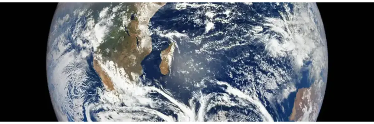
Do you know how beautiful our planet is? The most beautiful panoramas seen from space. Live Earth view happening right now from space at the International Space Station. Thanks to the wonders of modern technology, NASA TV has a channel where you can follow what is happening on board the International Space Station.
Weather News
Blood Moon Causes Intense Earthquakes Across the Globe
The British Geological Survey (BGS) explains the link between blood moons and recent earthquakes. On May 16, a lunar eclipse occurred for a brief moment on the fifth full moon of the year. This creates a reddish tint to the alien body seen from Earth. Stargazers and skywatchers around the world have observed the phenomenon known as the Blood Moon. earthquakes with a magnitude of up to 5.8 magnitude were recorded around the world about 12 hours after the full moon. According to the USGS, there are yet any significant earthquakes following the full moon. The USGS calculates the significance of earthquakes using an equation that quantifies magnitude, pager alert level, and "Did You Feel It" responses. ... Read more
'Small tornado' cloud spotted in the sky near Merseyside
A 'twist' cloud has been spotted in the sky near Merseyside. Paul Rimmer took pictures of the strange formation. He said he brought them near the Windmill Animal Farm on Fish Alley in Burscough around 16:50 p.m. Monday. He said he kept an eye on the cloud after noticing a "strange protrusion" on its edge. Paul said he could see it "growing up" and thought the way it formed could be a "mini-tornado". ... Read more
Turkey's Lake Salda looks like a swamp now
An environmental group has shared the latest image of Lake Salda, which deserves to be included in the list of UNESCO world natural heritage. In the video, we see that the water has receded and the lake has turned into a swamp. Water is continuously receding in Lake Salda due to projects that have caused damage to the area, as well as drilling and drought. Home to 301 species of plants, Lake Salda has been declared a "Special Protected Environmental Area" by a presidential decree in March 2019. However, Murat Kurum, Minister Environment, Urbanization and Climate Change announced the same year that a "Garden area" would be built near the lake. ... Read more
Euphrates river water decreases to alarming level
The Turkish government continues to block the influx of Syrian water into the Euphrates River, the main source of drinking water, irrigation and power generation. The confiscation of Turkey and the subsequent drought of the Euphrates River in Deir ez-Zor and other areas of northern and eastern Syria caused water pollution and dumping of debris in most of the river, imminent inhabitants of the area near the river. I am worried about the disaster. It is worth noting that the low water level of the Euphrates threatens summer crops irrigated in northeastern Syria, especially in the waters of the Deir ez-Zor river. In this regard, the head of the water problem at Deir ez-Zor commented on the problem of low water levels on the Euphrates River and warned of the imminent catastrophe. A source told SOHR: "Problems have been found in water stations and other issues that have affected farmland and livestock. The four water stations on the west route have been abolished. And they are big stations that supply water to the five villages of Al Kebar, Al Saghir and Al Sa'wa. People in these areas are suffering from recent low water levels as they have to buy water tanks at high prices, not to mention increased water pollution in rivers. " ... Read more
Extreme heat waves created ‘Heat Islands’ in Delhi, India
India has been suffering from unusually fast heat waves for months. This heat wave caused dozens of deaths, fires, increased air pollution, and reduced yields. And according to the weather forecast, there is no improvement in vision in the foreseeable future. NASA's ECOSTRESS Space Station Equipment Ecosystem Space Thermoradiometer Experiment (ECOSTRESS) records extreme temperatures in urban areas around Delhi, India, during historic heat waves. The instrument also measured these extreme temperatures from space with the highest spatial resolution of any satellite instrument. The ECOSTRESS has captured an image shortly before local midnight on May 5 showing urban areas and agricultural lands northwest of Delhi, home to about 28 million people. The image covers approximately 4,800 square miles (12,350 square kilometers). ... Read more
About WHATWEATHER.today
Weather in cities: Kuala Lumpur Klang Ipoh Butterworth Johor Bahru George Town Petaling Jaya Kuantan Shah Alam Kota Bharu Melaka Kota Kinabalu Seremban Sandakan Sungai Petani Kuching Kuala Terengganu Alor Setar Putrajaya Kangar Labuan Pasir Mas Tumpat Ketereh Kampung Lemal Pulai Chondong source: simplemaps.com